Newport and New Cohorts!

June 28th, 2019:

Hawaiian pancakes, farmers markets, whale flukes, beach runs, cherry pie, baby starfish, and brown weather boots—the staple associations I’ve made to Newport, Oregon and being a Sea Grant Summer Scholar thus far. To formally introduce myself, I’m Dominique—I just finished my junior year at UCLA, and was selected as a 2019 Summer Scholar for Position #2: Ecologically Monitoring the Oregon Marine Reserves. I’m currently stationed at the Hatfield Marine Science Center in Newport with four other Sea Grant Summer Scholars.

I can honestly say Newport is the most wholesome city I’ve ever visited—to paint as vivid of a picture as I can, it’s the exact opposite of Los Angeles (where I’ve lived the past 21 years). The air has that briny, crisp scent of seawater, traffic is nonexistent, dining options all comprise of “Mom & Pop” restaurants, and the people are shockingly friendly—they’ll actually make eye contact and chirp “Good Mornin’!” to you when you pass them in the street.  I’ve now had over a week to get used to the quaint, small-town/coastal vibes that Newport has to offer, and I absolutely love it. How could you not when your apartment is 50 feet away from the beach, an aquarium, and a baby seahawk nest?

View of the harbor from Newport Bridge

View of Newport Bridge from the South Jetty trail

Though I’m only here for 10 weeks, I’m trying to acclimate as quickly as I can to the active Oregon lifestyle. After work, I go on 3 mile jogs through the estuary trail and along the South Jetty (if you exit the Hatfield parking lot and pass the Rouge Brewery, there’s a mile-long trail that’ll lead you to some sand dunes and the cleanest stretch of beach I’ve ever seen). Last Saturday, the other Scholars and I walked into town—which is a 3 mile round-trip over the bridge—to check out the Farmer’s Market. We sampled orange-zest chocolate, cinnamon-sugar butter (the best thing you’ll ever try), smoked Colby-jack cheese, wild berry jam, and too many fresh cherries; I honestly don’t know how I got away with sampling that many without getting asked to buy some or leave—like I said, Oregon folk are nice. The next day, we did the 3-mile trek again to try out Pig-N-Pancake, the Newport staple brunch spot. We were lured in by the window advertisement of “Pineapple Coconut Pancakes”, and like every other food item I’ve tried in Newport, they did not disappoint.

Without a doubt, the best part of this internship has been my exposure to all things new: new people, new places, new food, new experiences—new knowledge. They say: “Ya’ learn something new every day” but here, I swear that’s not the case: I’m learning 12,203,942 new things every day. Last week my roommate taught me how to ferment and boil ginger to make kombucha. A few days ago my other roommate taught me how to make a multi-layered carrot cake with cream-cheese frosting from scratch. Just yesterday, my roommate (again!) taught me how to pit cherries and make pie crust without a rolling pin (hint: use a glass VOSS water bottle, it’ll do the trick). Most importantly, though, I’ve learned what it takes to be an Ecological Marine Reserves Monitor stationed on the Newport coast.

Cherries found at the Saturday morning Farmer’s Market

Ariana’s lattice cherry pie before getting baked in the oven!

I’m just now realizing that I’ve rattled on this entire time about food (it’s 2:06 pm in the office and I haven’t eaten lunch yet—you can guess where my mind is at). Let me finally introduce my work! (though I honestly shouldn’t even be calling it “work” because what I do is too fun to be associated with that gloomy connotation).  For 10 weeks this summer, I’m interning with the Oregon Department of Fish and Wildlife’s Ecological Marine Reserves team alongside Cori (my mentor), Lindsay, Jessica, and Stephanie. Our job is to ecologically monitor the five Marine Reserves along the coast—Cape Falcon, Cascade Head, Otter Rock, Cape Perpetua, and Redfish Rocks—via fish recruitment, urchin recruitment, sea star, and mussel bed surveys. Through these surveys, we can observe and analyze the changes in the rocky intertidal community since the Sea Star Wasting Disease (SSWD) outbreak hit the Oregon Coast in 2014 (I’ll elaborate on this a bit later). My job comes with lots of field work—Day 2 in Oregon and I was already half-submerged in tide pools tallying juvenile sea stars at Otter Rock! I’ll stop here before I delve deeper in the explanation of my internship and what I have planned these upcoming weeks—I have a ton of exciting field days scheduled and can easily rattle on for pages about what’s to come. I’ll save it for the next blog, so ~stay tuned~! :)

Me on my first day out in the field!

First Impressions as a Sea Grant Scholar

My name is Melissa Wood and I am a 2019 Oregon Sea Grant Scholar, which means spending 10 weeks on the Oregon coast while working with a marine science team. I have been here about 4 weeks and the Oregon coast is amazing. There are so many things to see and do that it feels like there will never be enough time for it all. As part of the Sea Grant Scholar experience, I am staying in a yurt (for the first time) on an estuary reserve. Here are some pictures from one of the yurts on the property and one of an attempt at the view but it is hard to do justice to the beauty of the area.

One of the yurts on the reserve.

Inside of the yurt showing bunk beds, table with chairs, and a dresser.

My attempt at capturing the view outside the yurts.


Yurt life has been an interesting cross between camping and staying at an Airbnb. What’s not shown in the pictures above is a ranch house, which sits right by the yurts with two bathrooms and a full kitchen, so yurt life has been sort of like camping but warmer and right next to all of the comforts of home. An added bonus is the yurt is on a nature reserve so it is located right next to hiking trails, bird watching trails, and a great kayaking spot. Yurt life has been an unexpectedly awesome part of the summer.

The real focus of being here this summer is to participate in a permanent project of the shellfish program within the Marine Resources Program of the Oregon Department of Fish and Wildlife (ODFW). Though the official project is titled ‘Shellfish and Estuarine Assessment of Coastal Oregon’ it is often shortened to SEACOR. The SEACOR team has a big job tracking clam populations and studying estuarine habitats along all of the bays in Oregon. The information collected is useful to recreational clammers by letting people know where to clam and what kinds of clams are found. Even more importantly, the data SEACOR provides is used for conservation purposes to ensure future generations will be able to enjoy the abundance of life and beauty of the Oregon estuaries.

My fourth week with the team has just finished and I have learned so much already. Everyone has been welcoming, patient, and willing to share their extensive knowledge about estuaries and the project.

This is data collection/field work season for SEACOR so that is what I am learning this summer. There are three main types of data collection going on this summer:

  • Rapid Assessment Method (RAM)
  • Detailed Assessment Method (DAM)
  • Eel grass habitat mapping using drones

My next post will have more detail about the data collection methods (hint, it involves lots and lots of mud). Until then here a picture of me learning how to megacore, part of the Detailed Assessment Method.

Image by: Bob Mapes

Supporting Collaboration and Data Accessibility on the West Coast of the U.S.

Less than one month ago, I began my Oregon Sea Grant Fellowship supporting the West Coast Ocean Alliance (WCOA) and West Coast Ocean Data Portal (WCODP). Since beginning, I have spent a considerable amount of time familiarizing myself with the history and composition of these unique entities.


The West Coast Ocean Alliance is a regional partnership that focuses on “enhanced management and coordination for the ocean along the West Coast of the U.S” (WCOA). It is made up of state, tribal, and federal representatives, and currently has four objectives: compatible and sustainable ocean uses, effective and transparent decision making, comprehensive ocean and coastal data, and increased understanding of and respect for tribal rights, traditional knowledge, resources and practices.

The current Alliance is part of a broader legacy of regional ocean coordination on the West Coast. In 2007, the governors of California, Oregon, and Washington created the West Coast Governors Agreement on Ocean Health. Focusing on topics like marine debris and coastal resilience, the West Coast Governors Agreement also prioritized data coordination and the creation of the West Coast Ocean Data Portal. In 2010, with Executive Order 13547, President Obama created our country’s first National Ocean Policy. This policy introduced a mechanism for creating Regional Planning Bodies (RPBs) that formalized federal engagement in regional ocean planning processes. The West Coast states and tribal governments began discussing the creation of an RPB in 2013, and in 2016 signed their formal charter. Concurrently, the West Coast Governors Agreement on Ocean Health evolved into the West Coast Governors Alliance on Ocean Health, a Regional West Coast Ocean Partnership that could work with the RPB. Finally, in June 2018, President Trump’s Executive Order 13840 replaced Obama’s National Ocean Policy, and terminated the active RPBs in the U.S. Official regional coordination could, however, continue through Regional Ocean Partnerships, and so the participants of the West Coast RPB and the West Coast Ocean Partnership elected to continue their coordination as the West Coast Ocean Alliance in late 2018.

This all sounds pretty complicated—so why bother with regional ocean coordination? Ecosystem functions and species, as well as ocean issues like pollution, do not respect jurisdictional boundaries. Therefore, state, tribal and federal decision-makers frequently need to work together on problem-solving and management decisions. Habitat loss in one state’s waters might inform management of a migratory species in another’s. Energy development in federal waters could affect multiple state and tribal fishing industries. So realistically, if we want to be effective coastal and ocean managers, we can’t afford not to coordinate on a regional scale—especially as the marine environment faces unprecedented changes and development pressure.

Check out all the different activities that can take place near one small part of the coast! (Image: NACo)

A huge part of that coordination is information sharing. It is important to ensure that regional discussions and decision-making are based on sound science and the most current data, which is where the West Coast Ocean Data Portal comes in. The WCODP is meant to be a one-stop-shop for state and tribal coastal and ocean managers, who are seeking to inform their decisions with relevant data and visualizations. Part of my Fellowship will be engaging with WCODP and WCOA members over the next year to determine the types of data that will be truly useful to different entities, the format in which they would like to see that data, and how we can set up long-term relationships to keep that data up-to-date. Below, see an example from the Data Portal that displays offshore wind resource potential on the West Coast.

The WCODP can help decision-makers who are siting Marine Renewable Energy (MRE) projects like floating wind turbines on the West Coast by summarizing and presenting relevant data in one location, and connecting managers, regulators, scientists and stakeholders.  (Image: WCODP)

I have already experienced my first WCOA member call, which included over 50 representatives speaking on behalf of different governing bodies with distinct interests and priorities. It is clear that high levels of organization and coordination are required to keep a group like this focused on a unified vision and specific objectives, and helping move the Alliance toward longer-term goals will be another important task of mine in the coming months.

It may be a challenging time for our oceans, but it is also an exciting one, as decision-makers explore innovative solutions and cooperate on regional scales to build a unified vision for our coastlines. I am grateful for the opportunity to be a part of this conversation on the West Coast, with so many motivated partners. Stay tuned for an update on how my position is going this December!

Reflections and Take-Aways on My Outreach Experience

Earlier this spring, I delivered my activity for the spring Challenge Events, hosted by OSU’s SMILE (Science & Math Investigative Learning Experiences) program, at the Marine Geology Repository (MGR). Over the course of two days, I guided ~60 high school students, ~100 elementary school students, and ~25 K-12 teachers through my hour-long lesson.

When students first arrived, I introduced them to the MGR and talked briefly about my experience as a woman in geoscience. I encouraged them to stick with STEM and pursue their dream careers. I then began the demonstration with a ~10-minute presentation about Oregon salt marshes, ecosystem services, threats to coastal areas, and how salt marshes record history. I then broke the students up into three groups of ~7 at three different tables, each with similar materials. Each table had a sediment core from a different Oregon salt marsh that displayed a 1700 Earthquake tsunami deposit (Picture 1). The students were able to touch the cores and look at samples under microscopes. After walking the students through a few lines of reasoning about where they observe the tsunami deposit based on visual changes, differences in grain size, and what they could observe on the microscopes, I led an experiment to compare carbon content within the sediment core. First, I had students predict which parts of the core had the most carbon, and which parts had the least amount of carbon. They then took three samples from the core and placed them into beakers. I placed these beakers on a hotplate and added hydrogen peroxide. After a few seconds, the samples began to bubble. We then debriefed the experiment, assessing whether their hypotheses were correct and why that was (or was not) the case. If there was time left, I encouraged the students to walk around the classroom and see the other cores for comparison to their own (they varied quite a lot). After each group had finished the experiment, we came back together as a whole group and I asked them a couple of questions: What was something cool that you saw? Did everyone find that you had a tsunami deposit? What did you predict would happen in your experiment? What did you actually see? Why do you think that was the case? Following this, the remainder of the time (~5 – 15 min) was spent touring the core lab facility, until they were transported to their next activity.

Picture 1. Activity set up.

I wanted to highlight some of my takeaways from the demonstrations in no particular order.

First, I learned that I have to be flexible and capable of altering my lesson plan in the moment. This requires constant assessment of how my audience is receiving information. If the material is too confusing or jargon-heavy, I need to slow down, simplify, and explain. Some of the groups found certain aspects of the demonstrations more interesting than others and so I was constantly altering the activity. I was really glad that I scheduled the tour at the end because we were able to extend this portion if we had finished earlier than expected or cut this portion short if we were running low on time.

Picture 2. Two students excited about touching 300-year-old, tsunami sand.

This may seem trivial, but the time of day really affects engagement. Perhaps unsurprisingly, I found that both students and teachers were the least engaged directly after lunch and at the very end of the day. I would watch people’s eyes glaze over if I spoke for too long or attempted to engage them in a difficult subject. During these times, I also noticed that the students were more poorly behaved – distracting other students or engaging a bit too roughly with the demonstration materials. I was also much more energetic and enthusiastic in the middle of the day. In the mornings I was nervous and a little out of practice. By the end of the day, I was tired and ready for dinner.

Everyone loves looking under microscopes. Even though I rarely look under the microscope for my own research, I will always incorporate microscopes into future demonstrations. The MGR has a number of very simple stereoscopes that were perfect for students to see the sediment up close. Some of the students were able to find foraminifera and Radiolaria (Picture 3). One student got so excited by it, that we preserved his Radiolaria between two pieces of packing tape so he could keep it.

Picture 3. Students trying to find Radiolaria and foraminifera.

It seemed like students were unfamiliar with salt marshes in their state, or the fact that Oregon is an active subduction zone that experiences large earthquakes. Despite this, they picked up the information quickly and I was constantly pleasantly surprised with their depth of questioning. Multiple students came up to me and said they wanted to become geologists when they were older – these were certainly the most rewarding experiences.

So, I think I was able to accomplish my goals:

✓ describe how sediment cores are collected in marine environments and how these samples are stored and processed at the MGR

✓ discuss the unique features of Oregon’s estuaries, the services they provide, and the threats they face

✓ visually analyze and compare salt marsh stratigraphy

✓ identify tsunami sand layers and place them within the context of Cascadia seismic history

I won’t know whether I’ve achieved my broader goal of influencing kids to pursue careers in STEM; however, I feel confident that I piqued their interest in geosciences.

Moving forward with my OSG Malouf Scholarship, I plan to present at Corvallis’s Di Vinci Days. Also, I will submit my lesson plan and materials to the MGR so that they are able to continue using my outreach activity. I’ll also be looking into ways to share my lesson plan with a broader audience, such as Carleton College’s SERC (the Science Education Resource Center at Carleton College) program.

A (Very) Brief History of the Oregon Dungeness Crab Fishery


Drawing by H.L. Todd, from No. 2553, U.S. National Museum. California, William Stimpson.

Landings of Dungeness crab were first recorded in Oregon in 1889 and have continued to constitute a major fishery resource ever since. Over time, the fishery has seen increased participation, changing technology, and improved understanding of crab biology and population dynamics which have shaped the management system that is in place today.

Crabbing began in the major bays and other protected waters along the Oregon coast. Gradually, these efforts expanded to the open ocean where the vast majority of commercial crabbing in Oregon now takes place. From 1909 to 1933, commercial fishers were subject to daily and/or annual bag limits. When these catch limits were repealed in 1933, a sharp increase in landings occurred and continued until 1948 with crabbing for both male and female crabs open year round.

In 1948, the first seasonal closures began in Oregon with the goal of reducing the catch of crab that are in poor condition (i.e., low meat yield) during times when molting takes place. At the same time, the harvest of female crabs was first prohibited (which was practiced long before it was set in rule) in an effort to support the reproductive output of the population. Size regulations were first implemented in the early 1900s and have remained largely unchanged. Size limits were enacted with little knowledge of the species biology, however, research now supports a 6.25” (159 mm) minimum carapace width which allows male crabs to reproduce for at least one season before being targeted by the fishery. These three components (i.e., size, sex, and season) constitute the “3-S” management strategy that is employed by Dungeness crab fisheries along the coast.

Over time, additional management measures have been adopted to limit effort in the Dungeness crab fishery and to reduce the impacts of lost or abandoned gear. In 1995, a limited entry program was implemented allowing for a set number of available vessel permits. In 2006, a three-tiered pot limit system (200, 300, and 500 pots) was adopted to control the gear capacity of the fishery. Regulations are also in place in the commercial fishery requiring 4.25” escape rings, biodegradable release mechanisms, and buoy marking for identification.

Dungeness crab has always been managed at the state level, but there is a history of interstate cooperation to standardize measurement methods, coordinate opening dates, and maintain consistency in other regulations. A Memorandum of Understanding (MOU) between Washington, Oregon, and California was first signed in 1980 and subsequently amended to formalize each state’s commitment to mutually supportive management of the resource. In 1990, the Tri-State Dungeness Crab Committee was coordinated by the Pacific States Marine Fisheries Commission (PSMFC) to provide a forum for negotiating issues that affect more than one state’s fishery.

During my fellowship with Oregon Department of Fish and Wildlife (ODFW), one of the major challenges is researching and documenting the changes that have taken place in the fishery over time and the management decisions that have led to the current regulatory structure. In addition to the long history of the ocean commercial Dungeness crab fishery, a targeted bay commercial fishery and active recreational fishery for Dungeness crab also exist. I am working to include a detailed description of each of these fisheries and an assessment of the challenges they face to support coordinated management and minimized complexity.

From the early days of the fishery when crabs were landed by the dozen to the current transition to an electronic Fish Ticket system, the Dungeness crab fishery in Oregon has a long and rich history. As I approach the halfway point in my fellowship, I look forward to shifting gears from describing the current status of the resource (e.g., biological information, threats to the resource, available data, and research gaps) to a closer look at the historical and current management strategy for this important fishery resource.


[1] Demory, D. 1990. History and status of the Oregon Dungeness crab fishery. Oregon Department of Fish and Wildlife, Marine Region, 12 pp.

[2] Didier, A. J., Jr. 2002. The Pacific coast Dungeness crab fishery. Pacific States Marine Fisheries Commission, 30 pp.

[3] Rasmuson, L. K. 2013. The biology, ecology and fishery of the Dungeness crab, Cancer magister. Advances in Marine Biology, 65: 95–148.

[4] Waldron, K. D. 1958. The fishery and biology of the Dungeness crab (Cancer magister Dana) in Oregon waters. Fish Commission of Oregon, Contribution No. 24, 43 pp.

Getting My Hands Dirty ~ Designing a Series of Interactive Experiences Using Sediment Cores

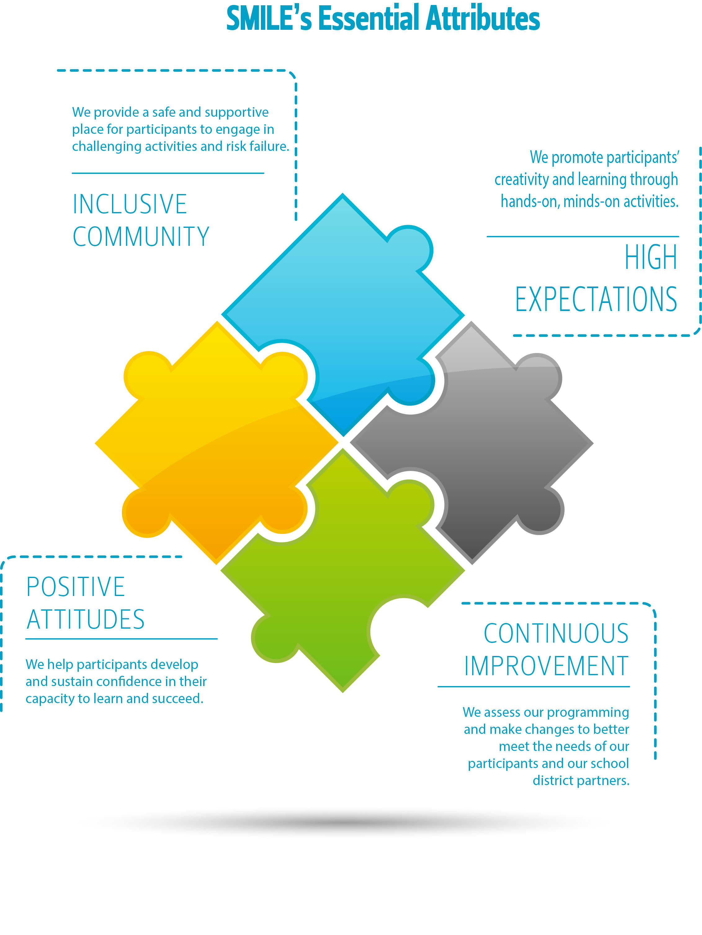
Every spring, Oregon State University’s SMILE (Science & Math Investigative Learning Experiences) program, which is part of the Office of Precollege Programs, hosts Challenge events for high school, middle school, and elementary school students. These K-12 students are involved in SMILE clubs all over the state of Oregon. SMILE’s mission is to “increase underrepresented students’ success in STEM degree programs and careers and deliver high-quality teacher professional development” [1].

I am designing an activity for the spring Challenge Events at OSU’s new Marine Geology Repository (MGR) for elementary students (4th and 5th grade) and high school students (9th through 12th grade). Each group of ~25 students will visit the MGR for 1 hour.

I have designed each event with the Next Generation Science Standards (NGSS) in mind. For the high school students, I’ve drawn from HS-ESS2-6, which strives to, “develop a quantitative model to describe the cycling of carbon among the hydrosphere, atmosphere, geosphere, and biosphere. [emphasis is on modelling biogeochemical cycles that include the cycling of carbon through the ocean, atmosphere, soil and biosphere (including humans), providing that foundation for living organisms]” [2]. For the elementary students, I’ve drawn from the disciplinary core ideas for 4th graders related to understanding the history of the Earth and how living things affect the physical characteristics of their regions. For all K-12 students, the NGSS seeks to instil an enduring understanding of the scientific method. Thus, my broad objective is for learners to have an enduring understanding of estuarine habitats and their ecosystem services (especially carbon burial) so they can rationally use and advocate for conservation of coastal resources. Another important goal is for students to see themselves as scientists. I will therefore both speak about my pathway into science and also set up the activities to follow hypothesis-based lines of reasoning.

This is a lot to accomplish in only one hour! I’ve been working to design a lesson plan that covers all of these topics in hands-on activities that fit into my limited timeframe. I plan to allocate 10 minutes to welcoming the students to the core lab, describing the MGR, and talking about my path into science. We’ll then have a 10-minute discussion about the carbon cycle, why it’s important for global climate, and where carbon gets stored. I’ll also play our video of how we collect sediment cores.


Students will then be divided into groups of three and the next twenty minutes will be devoted to a hands-on activity assessing carbon concentrations within a sediment core. The cores I’ve chosen for each group will have obvious stratigraphy, with many different layers of sand, silt, and clay (below is an example). Along the length of the core, I will have a timeline so the students can get a sense of the timeframe over which salt marshes record environmental history. Samples from the core that vary in terms of organic matter content will also be set up under stereoscopes for students to look at the core material in detail. The students will have the ability to feel the sediment and look at it using hand lenses, as well. After the students have been able to observe the core, the aid at the table will ask the students to formulate a hypothesis about what kind of sediment from the core will have the highest carbon content. They will then take small samples (~3) and put them in beakers on a hot plate. A little bit of hydrogen peroxide will then be poured over the samples and the ones that bubble the most will have the highest organic matter content. They will then assess their hypothesis and the aid will lead them through a series of follow up questions. For instance, what kind of sediment (mud or sand) stores the most carbon? What other kinds of factors might influence the amount of carbon buried in salt marshes?

CT scan of an example sediment core used in the activities. The lighter portions of the image are more dense, sandy material. Darker portions of the image are less dense, organic-rich sediment. The left side of the core is the top, which is present day.

Following the activity, we’ll all come back together for a short, ~10-min discussion of what they learned, and I will answer final questions from students. In the remaining time, students will be led on a short tour of the MGR.

Throughout this process, I’ve received a lot of helpful advice and support from friends and colleagues. Members of the College of Earth, Ocean, and Atmospheric Sciences (CEOAS) Science Communication group, including Abby Metzger (the Communication Manager in CEOAS), have provided me with advice along the way and have donated their time to a mock demonstration at the MGR. At the OSU MGR, the education and outreach coordinator, Cara Fritz, and other staff (Maziet Cheseby, Coquille Rex, and Valerie Stanley) have been wonderful sources of knowledge. Cara has additionally graciously agreed to help during the Challenge Events. Additionally, I’m very grateful to the staff at Precollege Programs. I’ve been working with Jay Well, who has been extremely helpful and generous with his time. Outreach takes a village!

Citations:
[1] https://smile.oregonstate.edu/mission
[2] https://www.nextgenscience.org/sites/default/files/AllTopic.pdf

Life in Newport: My Introduction to Oregon’s State Crustacean

Posted on behalf of Brittany Harrington

For those of you who have spent time on the Oregon coast in December, you’ve almost certainly heard talk of the commercial crab season opening. These conversations aren’t confined to the docks or a visit to the ODFW office, they can be heard over dinner at any one of the local seafood restaurants, in line at the grocery store, or casually discussed on the city bus.

As the most valuable single species fishery in Oregon, Dungeness crab represent an important source of income to many of the people and communities along the coast. Landings of Dungeness crab have been recorded in Oregon since 1889 and, since that time, three very active targeted fisheries have developed surrounding this species. The fisheries are managed at the state level with the Oregon Department of Fish and Wildlife (ODFW) as the lead agency. However, managers currently face a number of complex management challenges associated with this key resource.

Over the past three months, I have had the opportunity to closely observe many of the conversations about Dungeness crab between fishery managers, industry members, and the broader coastal community. In December, I was brought on to work alongside staff from ODFW’s Marine Resources Program (MRP) to develop a Fisheries Management Plan (FMP) for the Dungeness crab fisheries in Oregon. My position is supported by the Nature Conservancy, who shares the goal of developing FMPs that allow for equitable access to marine resources while promoting the sustainability of fishery species.

I have a degree in Marine Resource Management from OSU and have spent many hours learning about different principles and practices in fisheries management, but I was particularly excited about this fellowship because it would allow me to be a part of the process and experience the practical applications of those topics that I knew largely from textbooks. I looked forward to learning from the many years of experience of the fishery managers that I am working with and from the complex interactions between stakeholders. What I had not anticipated, was how much I would learn simply from living in the town of Newport and exploring my new coastal community.

So far, the list of experiences that I’ve had in this position have been extremely diverse and rewarding. I’ve been able to dive into research on historical and existing policies surrounding the commercial and recreational crab fisheries in Oregon. I’ve assisted with hold inspections and dockside sampling which allowed me to interact with fishermen in a variety of positions and on different vessels ranging from small boats that fish for several hours and hold less than 1000 lbs of crab, to those that spend two weeks at sea and return with 150,000 lbs. I’ve attended meetings of the Oregon Dungeness Crab Advisory Committee (ODCAC) which has provided me a glimpse of the unique needs and perspectives within the commercial crab industry that we will strive to encompass in the crab FMP.

However, I would add to that list that I have also eaten in restaurants eagerly anticipating the influx of fresh crab that draws crowds of locals and tourists alike. I have witnessed the community mourning the loss of their own after the tragic death of three crab fishermen in the capsizing of the Mary B II in January. And I frequently walk along the working waterfront in Newport and observe the many indirect ties between crabbing and other local businesses.

Given the suite of emerging issues and changing ocean conditions related to this fishery, a fisheries management plan for Dungeness crab will not only provide an important, comprehensive tool for managers, but will also help to support a fishery that is central to the culture and identity of the Oregon coast. I look forward to learning more as I continue to become a part of the Newport community.

Trying my hand at recreational crabbing back in 2017 with former OSG Fellow, Deanna Caracciolo, and my husband, Cole (note: we did, in fact, get some crab that day!)

Much to my dismay, I have yet to take the obligatory headshot holding a crab for use in all work-related presentations, so instead, here is a picture of me and my pup, Charlie, enjoying a beautiful day exploring our new home!”

Fire and Drought and El Niño, Oh My!

Oregon Sea Grant Sponsored Study Looks at Improving Communication About Environmental Conditions Between Scientific Experts and Oregon’s Natural Resource Managers

It was the beginning of 2016. Unusually warm seawater named “The Blob” collected in the North-East Pacific Ocean. A massive harmful algal bloom formed in Oregon’s coastal waters. High amounts of a marine biotoxin called domoic acid resulted in closures of the recreational razor clam fishery. Almost 5,000 people along the North Coast (where the majority of recreational razor clamming occurs) stayed home because of this closure. “…You can imagine the lost economic opportunities,” said the Oregon Department of Fish and Wildlife Shellfish Program Manager. “People don’t come out and rent vacation homes or they don’t go camping, they’re not eating in the restaurants, state parks are not filled; all those kinds of things occur because we’ve made this decision to not allow harvest.”

This is just one example of how changing ocean conditions are affecting Oregon’s coastal communities. Now, researchers at Oregon State University are evaluating a National Oceanic and Atmospheric Administration (NOAA) webinar called NOAA West Watch. Specifically, they are seeing if the webinar can be changed to communicate these extreme environmental conditions to Oregon’s natural resource managers. Currently, NOAA West Watch communicates information about abnormal environmental conditions to NOAA scientists.

Specifically, the research team is including Oregon’s natural resource managers in this webinar to improve regional coordination and communication. This could lead to a more ecosystem-based view for problem solving. To do this, the researchers are inviting a variety of Oregon resource managers, local scientists, and non-governmental organizations to watch the webinars and provide feedback on how to improve the webinar for a more manager-friendly audience.

Why do we need a more “ecosystem-based” view and manager-friendly audience, you may ask? Historically, much of our natural resource science and management occurred on a sector-basis. For example, scientists who studied fisheries often didn’t talk to scientists who studied estuaries. The same often occurred with management, as agencies have specific jobs and management roles in the environment. Managers had to find information across many subjects and determine what was important for their decision-making. Over the past couple of decades, management has shifted to an ecosystem-based management (EBM) framework that considers all ecological and human connections within and to the environment. Despite this mentality shift, natural resource science and management is still highly disjointed.

Strengthening connections between natural resource science and management is increasingly important as our coastal ocean changes. Accordingly, both scientists and managers will have to anticipate and plan for changes to our environment and resources. Evaluating NOAA West Watch can determine if this communication tool can support EBM by including a variety of scientists and managers in a setting that is responsive and adaptive to environmental changes on the West Coast.

Taking A Deep (Ocean) Dive into EBM

To determine if NOAA West Watch is a useful tool for supporting EBM, researchers are evaluating the following:

  1. the most useful spatial scale for information;
  2. if it can connect human and natural systems;
  3. if it can serve as a way for discussing competing environmental values and uses; and
  4. if it can be flexible to changes in the natural and human environments.

On a cold, windy day along the Oregon Coast, it can be easy to want to head indoors and forget about the rest of the world. But as a larger ecosystem, Oregon’s coast is connected not only to the surrounding ocean environment, but also to land. Additionally, the coast serves as a place where humans make connections, including providing opportunities for managers and scientists to work together. Scientists and managers are tasked with effectively studying and managing this diverse, changing ecosystem. To do so, they need to understand ecological and human connections that are occurring in the coastal region. “Sometimes we get so focused on what is happening here that we might fail to look at connections that are happening in other places,” said one Oregon resource manager who participated in the study.

The Oregon State researchers think NOAA West Watch may be able to explore these connections. In particular, the evaluation seeks to determine the most useful spatial scale for the webinar’s information. By considering the West Coast as an ecosystem, scientists can communicate changes in large-scale environmental conditions. Managers would then respond to those changes that can impact local environments and communities. An estuary manager who participated in the study shared, “Thinking about those kinds of bigger-picture issues is always helpful. It takes the blinders off so you’re not just looking at your little estuary; there’s these bigger conditions and factors that are influencing what you’re seeing.”

Additionally, the researchers are seeing if NOAA West Watch can help with the reporting of Oregon’s local marine environmental impacts. As community representatives, Oregon’s managers would speak for a local perspective in global environmental changes. Managers can share community environmental observations with NOAA employees during NOAA West Watch. NOAA can then include these observations in future science and policy. Initial results indicate that NOAA West Watch can help communicate human connections in the larger western regional ecosystem.


 Large waves hit Haystack Rock in Pacific City, Oregon Crab pots sit on a fishing dock in Oregon.
Examples of unusual environmental conditions and their impacts to Oregon that were presented in NOAA West Watch. Left, large offshore storms created record high waves along the Oregon coast in January of 2018 that left one dead. Right, delays to commercial Dungeness crabbing along the West Coast resulted in $400 million of direct impacts in January of 2017.


Furthermore, evaluators are determining if NOAA West Watch can bring together a wide range of science and management fields to build communication among competing coastal users. Given the ocean’s limited space, stakeholders need to discuss which ocean uses they prefer. However, it can be difficult to explore costs and benefits of certain uses if information is distributed across natural resource subjects. This research seeks to represent a variety of Oregon’s coastal science and management interest in NOAA West Watch webinars. Broad representation may help promote individual connections to build into institutional partnerships.

Compared to land environments, the ocean is generally not as well understood. Therefore, Oregon resource managers have to be flexible to changes in scientific progress. NOAA West Watch may help improve understanding by quickly combining and communicating environmental condition information; Oregon’s managers could then use that information for decision-making. Frequent webinars may help managers monitor changing physical conditions used to anticipate biological events. For example, managers can keep an eye on conditions that may lead to harmful algal blooms and shellfish fishery closures.

January 2017 clorophyll off in Oregon's coastal ocean. March 2017 chlorophyll off Oregon's coast.
NOAA West Watch webinars present environmental condition information to follow changes in the coastal ocean, such as these maps of chlorophyll concentration which can indicate harmful algal blooms. On the left, January 2017 conditions show a low number of phytoplankton, our marine plants. However, two months later (right), chlorophyll concentrations increase, indicating that a harmful algal bloom may be developing.


Keeping Pace with Oregon’s Changing Environment

With a changing climate, Oregon is expected to have increased droughts, changes in fish distribution, and increased wildfires. Natural resource scientists and managers have to predict and plan for these types of changes. Oregonians have recreational, economic, cultural, or personal interests in ensuring our resources are managed sustainably for long-term public use.

Ecosystem-based management is a framework that managers work under, and scientists can inform. Better communication can help managers understand our changing environment. Results from this NOAA West Watch evaluation suggest that this communication tool can be changed to fit the needs of an EBM management system. It can connect scientists and Oregon’s natural resource managers to promote collaboration and co-management.

As our coastal environment changes, what marine resources are you concerned about managing? [Comment below!]


How I Rediscovered My Love of Dirt

Believe it or not, my fascination with sediment started at about 10 months old. My first ever word was “dirt” (though my mother hotly refutes my father’s recollection of this milestone as she’s certain my first word was “mama”). Despite this early indication of my future passion, my interest in mud somewhat waned in late childhood and all but vanished in high school, as my science classes focused on human anatomy, physics, and chemistry. Who can guess what career path I would be following today had I not been placed, thanks to a testing error, in advanced calculus during my first semester of college? Quickly realizing I was in way over my head, I switched to the only available course that would fit my schedule – introductory geology. My interest in the natural world was quickly rekindled, this time from a more scientific viewpoint. Thanks to my professors and research projects, I discovered my passion for studying coupled human-environment systems, climate change, landscape geochemistry and, of course, mud. Fast forward to today, and I’m a graduate student studying coastal sediment dynamics within Oregon’s estuaries.

3-year-old Erin investigating sedimentary beds in an outcrop in Bermuda.

I outline my somewhat serendipitous path into the earth sciences for the following reason: though the natural world fascinated me from an early age, had I not had the dumb luck to switch into a geology course in college, I would not be studying sediment biogeochemistry today. When I applied to Oregon Sea Grant’s Malouf Scholarship, I did so with the goal of providing kids with exposure to earth science research starting at a young age.

Though most children possess a curiosity about the nature they find in their backyards, K-12 students don’t often take their first science course until high school [1], and many schools choose to focus on physical and life sciences. A 2012-2013 study by the American Geosciences Institute found that only one state required high school students to take a year-long earth and environmental science course for graduation, and only six states required that Earth & Space Science topics be covered for graduation [2]. This is despite the fact that the National Science Standards has placed equal importance on Earth and Space Sciences. Many scientific organizations have also called for equal inclusion of earth science education in K-12 science curricula, including the Geological Society of America, which released a position statement on this topic [3]. Recently, environmental education has received more attention through the introduction of the Next Generation Science Standards (NGSS), which strives to teach physical, life, and earth & space sciences using inquiry-based course design.

So why is environmental education gaining momentum in K-12 education? Research conducted by eeWorks (a partnership between the North American Association for Environmental Education and Stanford University) found that environmental education improved students’ knowledge in other important fields (including science, math, reading, and writing); emotional and social skills; and academic skills (critical and analytical thinking, and communication). Moreover, it increased students’ desire to learn, environmentally conscious behavior, and interest in civic engagement [4].

Improved knowledge of the earth and natural processes is just the tip of the iceberg for K-12 students who participate in environmental education. Students also showed improvement in other areas [4].

Since beginning my year as a Malouf Scholar I’ve learned a lot about K-12 earth science education. One thing I’ve learned is that there are many others in the state of Oregon who are invested in environmental education beginning in formative years and continuing on through high school. Oregon was one of 26 states nationwide that adopted the NGSS in 2014. Though updates to the Oregon Science Standards has been incremental, the state’s NGSS incorporate disciplinary core ideas related to Earth and Space Sciences that explore environmental science topics related to human activity. The NGSS earth science concepts are now introduced during earlier ages and continue throughout K-12 education. Moreover, NGSS increase student interest in learning by focusing on crosscutting concepts that connect different areas of STEM [5].

Throughout the next few months I’ll learn even more about enhancing environmental education as I finish planning, execute, and reflect on a series of educational events for K-12 students in Oregon. In my next post, I’ll describe the events … Stay tuned!

[1] https://www.nytimes.com/2013/04/10/science/panel-calls-for-broad-changes-in-science-education.html
[2] https://www.americangeosciences.org/sites/default/files/education-ESS-sec-status-report-2013-09-01-13.pdf
[3] https://www.geosociety.org/documents/gsa/positions/pos4_TeachingEarthScience.pdf
[4] https://naaee.org/eepro/research/eeworks/student-outcomes
[5] https://www.oregon.gov/ode/educator-resources/standards/science/Documents/ngss-fact-sheet—teachers-final-7-27-14.pdf

The Beginning of My Year as a Malouf Scholar

Hi everyone! My name is Emily Mazur, and I’m one of the new Sea Grant Malouf Scholars. I am currently in my second year of my Master’s program in Marine Resource Management at OSU. I am very excited to continue building my relationship with Oregon Sea Grant and Oregon’s coastal communities!

~My journey to graduate school and Oregon~

Before I dive in to my graduate and Malouf work, I want to introduce myself a little further. Growing up in California’s Sacramento Valley, my experience with the ocean was very different from people’s perception of warm LA waters and surfing. Instead, I grew up exploring the tide pools of Northern California, unaware of the diverse life under the sea until we took a family vacation to Hawaii and I snorkeled a tropical reef.


A young Emily discovering her affinity for the ocean. (Photo credit: Emily Mazur)

It was on that vacation that I fell in love with the ocean and was determined to learn how I could protect it. I attended college at the University of Miami (I wanted to be in as sunny of a climate as possible!), where I studied marine biology with a marine policy minor. As an undergrad, I had a truly transformative study abroad experience in the Galapagos Island, Ecuador. Prior to living abroad, I had  only been exposed to the science and tourism aspects of the ocean. While in the Galapagos, I began to understand and appreciate the essential roles that the ocean plays in all aspects of community life. From that experience onward, I knew I wanted to work with communities as a representative of their voice in science and management of coastal resources.

The Galapagos community loves their marine creates, such as this Green sea turtle! (Photo credit: Emily Mazur)


This is how I ended up here, back on the Best Coast, working with Sea Grant to get an interdisciplinary degree.

~My research~

My research focuses on how to communicate science to our coastal natural resource managers. I want you to think about your favorite coastal resource. Is it shellfish that you harvest at the beach? Fresh fish that you buy from a local fish market? Maybe it’s simply just enjoying our coastline – the rocky intertidal tide pools or state beaches. Now I want you to think of the groups that may manage these resources – fisheries managers, the coastal program, water managers. When these managers make decisions about our resources, we trust that they have access to scientific information to make the best decisions possible. However, it has been difficult for scientists to communicate the necessary scientific information required for resource managers to make the best decisions. This is where my research comes in.

I am working with a webinar series called NOAA (National Oceanic and Atmospheric Administration) West Watch that takes information about environmental and coastal conditions (and the impacts of abnormal phenomena) on the West Coast and makes it directly available to resource managers. We think that this webinar can be used as a mechanism for scientists and managers to communicate directly, co-creating knowledge in a less formal capacity than meetings and conferences. We see West Watch as a forum where our natural resource managers can get scientific information they need to make decisions, as well have our managers communicate Oregon’s informational needs to scientific experts.

~My first term as a Malouf Scholar~

So what does my life look like as a researcher and Malouf Scholar? I spend a lot of time building relationships with our state’s natural resource managers through direct communication. This includes trying to figure out our manager’s informational needs to see if NOAA West Watch can be adapted to fit those needs. It is important to build trust, and experiencing a variety of science and management perspectives has made me more aware of how people perceive the environment.

This term has given me opportunities to have face-to-face interactions with a variety of Oregon coastal stakeholders. At Sea Grant Scholar’s Day in October, I saw the diverse student research that Oregon Sea Grant funds, and had thought-provoking conversations with students about my research. At Oregon’s State of the Coast conference, I presented my research and gained valuable insight from both our scientists and managers about the challenges we face with science communication.

Chatting with a coastal stakeholder at the State of the Coast conference this past October. (Photo credit: Oregon Sea Grant)

~Moving forward…~

I would love to use the blog as a way to connect with those who are interested in Sea Grant and our coast. To encourage interactions and dialogue, I will be posing a question at the end of each blog post. For this post, I would like to hear from you about….

What are some abnormal things you’ve seen in the Oregon environment recently (e.g. temperature changes, water changes, animal changes, plant changes, fire, etc.)?